WebMap
Copyright ©1999-2005 Ing. Tomáš Rylek, Hydrosoft Veleslavín, spol. s r.o.
This is an integrated desktop GIS / map server system. You can use the built-in editor to design and assemble map presentations, charts, descriptive web pages and other relevant information into complex projects you can then serve over the internet using Java and HTML-based clients.
Database technology:
|
Supports connections to Oracle 7/8 (OCI), OLE-DB connections, and SDE connections
|
Source files:
|
cca 250 files in 4 special package plus 33 uppsrc packages
|
Number of lines:
|
cca 140000 (not including the uppsrc packages)
|
Application style:
|
editing GIS-related metainformation, alphanumerical & graphical editation and querying, primary data management
|
Distinctive features:
|
Heavy use of vector and raster graphics (optimized for fast map drawing), built-in map server, highly customizable using built-in expression evaluator. Supports multiple GIS data sources (shapefiles, SDE vectors and rasters, plain database tables, an internal archive format, Czech cadastral format VFK, OpenGIS-based data).
|
Web site:
|
www.webmap.cz
|
|
The built-in editor lets you organize GIS map layers into complex presentations featuring thematic rendering, labeling, and charts.
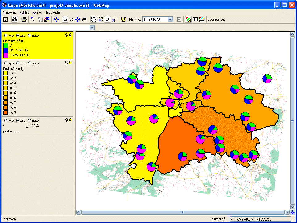
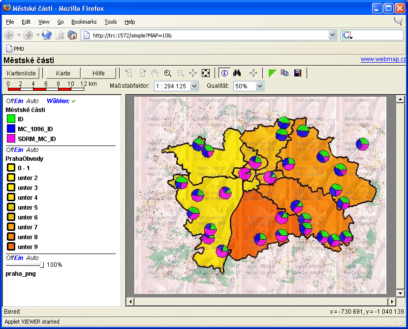
After composing the presentation you can use the map server to present your data over the internet.
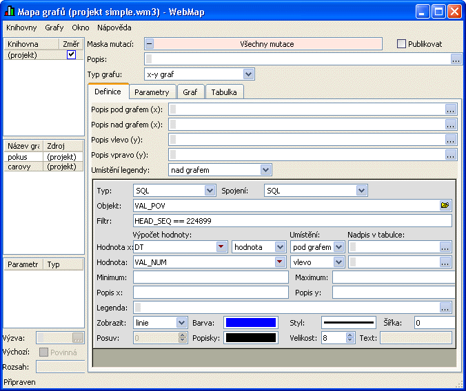
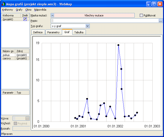
Other editor features include parametric chart definitions. You can use the connected data sources to retrieve generic data and format them into charts.
Other features include:
user access right definitions limiting access to maps / data
generic template editor used to build dynamic web presentations
support for geographic transformations
support for custom icons and line styles for graphical output
a built-in SDE raster manager
print layout editor with PDF generation support
|